September 25-27, 2014
Tower 1 Gully on Mount Helen is considered the premier alpine ice climb in Wyoming’s Wind River Range. It’s a long, moderate alpine ice route that has been on my hit list for a while. Opportunities for climbing ice in the fall are not that common in my area of the country, so I was stoked to finally get this one checked off. Here’s what the guidebook has to say about this route:
“Tower 1Gully (IV Al 3+). The north-facing couloir between Towers 1 and 2 appears especially fearsome when viewed from Dinwoody Pass. With ten pitches and steepness up to 60 degrees, Tower 1 Gully is the Wind Rivers’ classic ice route. It is comparable in length and difficulty to the Grand Teton’s Black Ice Couloir, though never as hard as the Black Ice’s crux.You can anchor belays in adjacent rock.”
(Joe Kelsey. Climbing and Hiking in the Wind River Mountains, 3rd Edition)
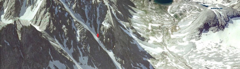
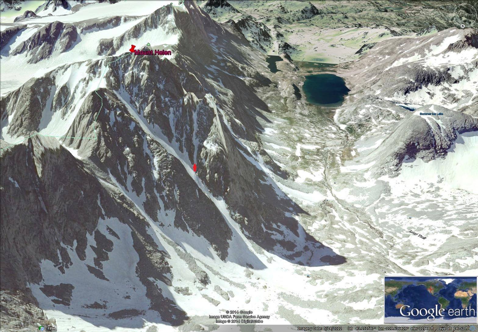
I didn’t get a decent picture of the entire climb, so here’s a photo of the climb taken from space (via Google Earth.) The red arrow shows the start of the actual climbing on the route. This photo was taken early season. Our conditions were quite a bit less snowy.
Mount Helen is located in the Titcomb Basin part of the Wind River Range. It’s about a 17 mile hike from the Elkhart Park trailhead just outside of the town of Pinedale. We decided to break up the approach hike into two days. I picked up my partner, Dallen, at 4:00 a.m. Thursday morning, and drove from Salt Lake to the trailhead, stopping in Pinedale for breakfast along the way. With our early start, we were hiking before 10:00 a.m.
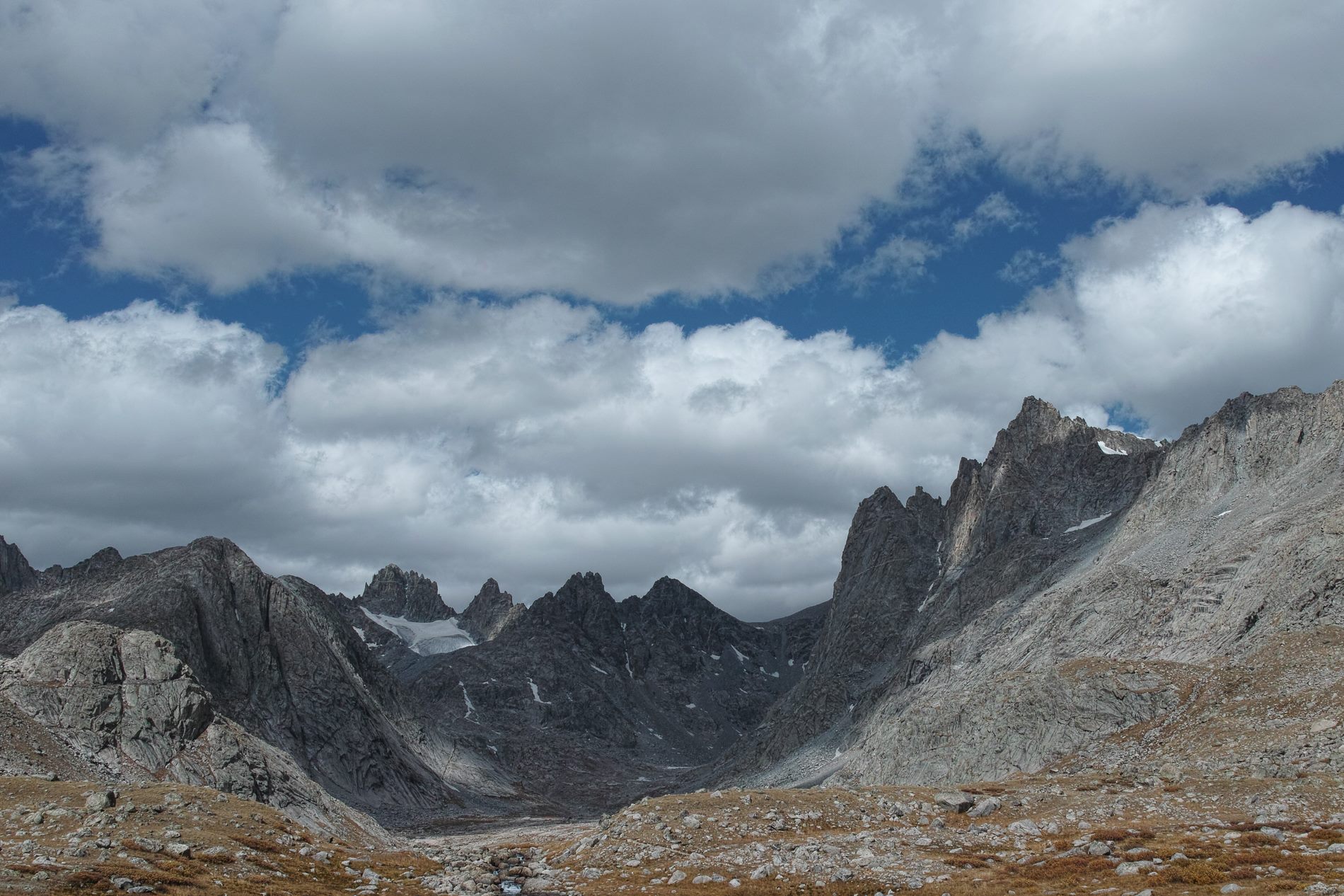
The trail to Titcomb Basin is pretty pleasant, with relatively gentle gradients and beautiful scenery. We stopped along the way to fish a bit, but we didn’t catch anything. We ended up camping Thursday evening between Seneca Lake and Little Seneca Lake, about 10 miles from the trailhead. We fished a bit that evening, again without any success. Weather was beautiful, with clear skies and mild temperatures.
Friday, we continued our approach hike in to Titcomb basin. We hiked about five and a half miles, and set up our camp between the upper and middle Titcomb lakes. It was a beautiful spot, with a great view of the towers, including Mount Helen’s Tower 1, our objective for the following day. (Although our particular route was on the other side of the mountain.)
We spent the rest of the evening reconnoitering the approach to the route, fishing, and relaxing. Dallen caught a big, beautiful golden trout, I caught a small rainbow, and we packed up for the next day’s climb. The most exciting thing, however, is that we saw a wolverine walking along not far from our camp. I’ve never seen a wolverine in the wild before. It was really cool to see it there, moving along with its odd, bounding gait. It kept its distance from us, and I wasn’t able to get a decent photo because of how far away it was.
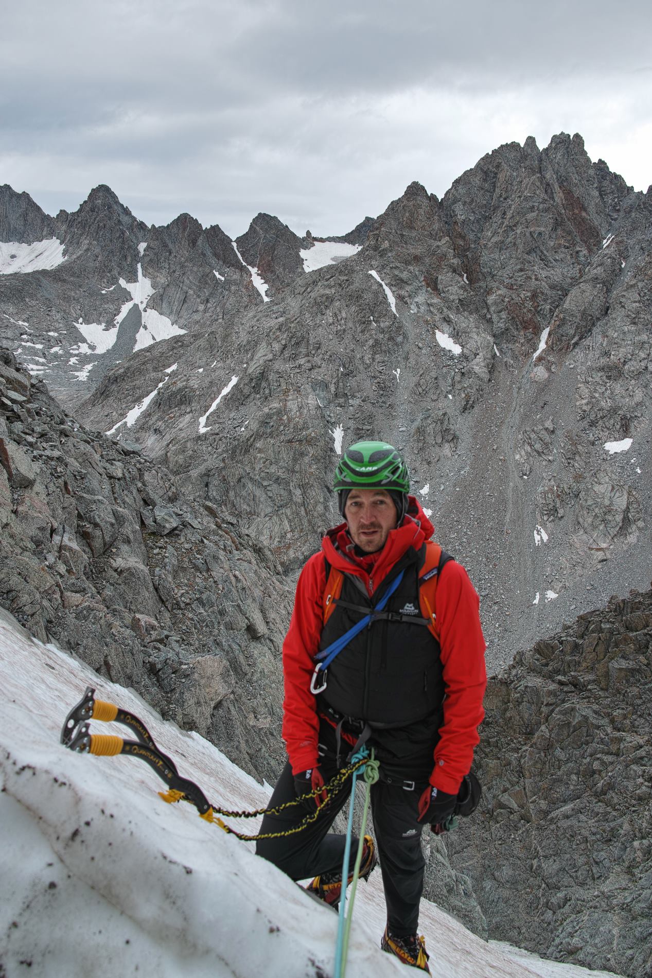
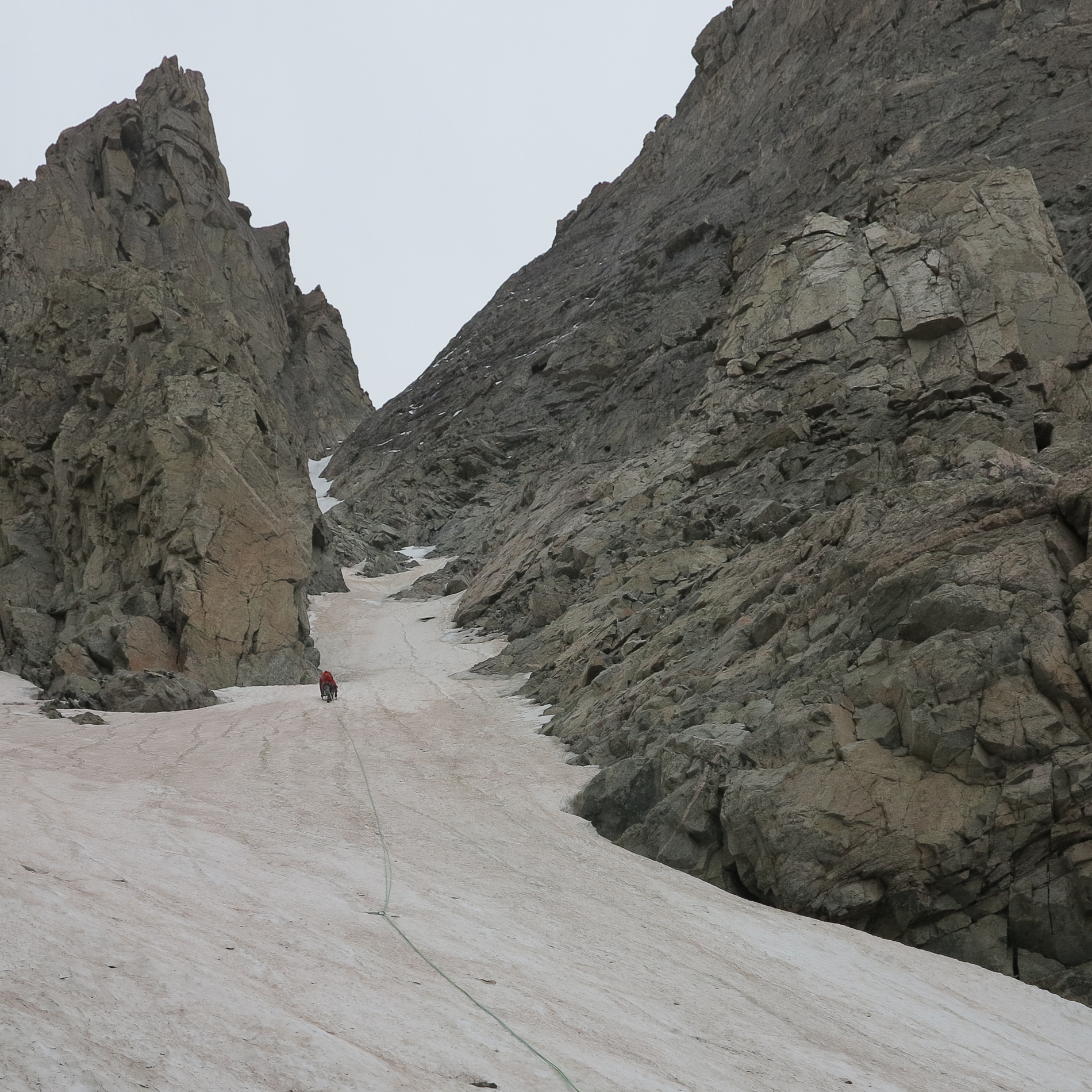
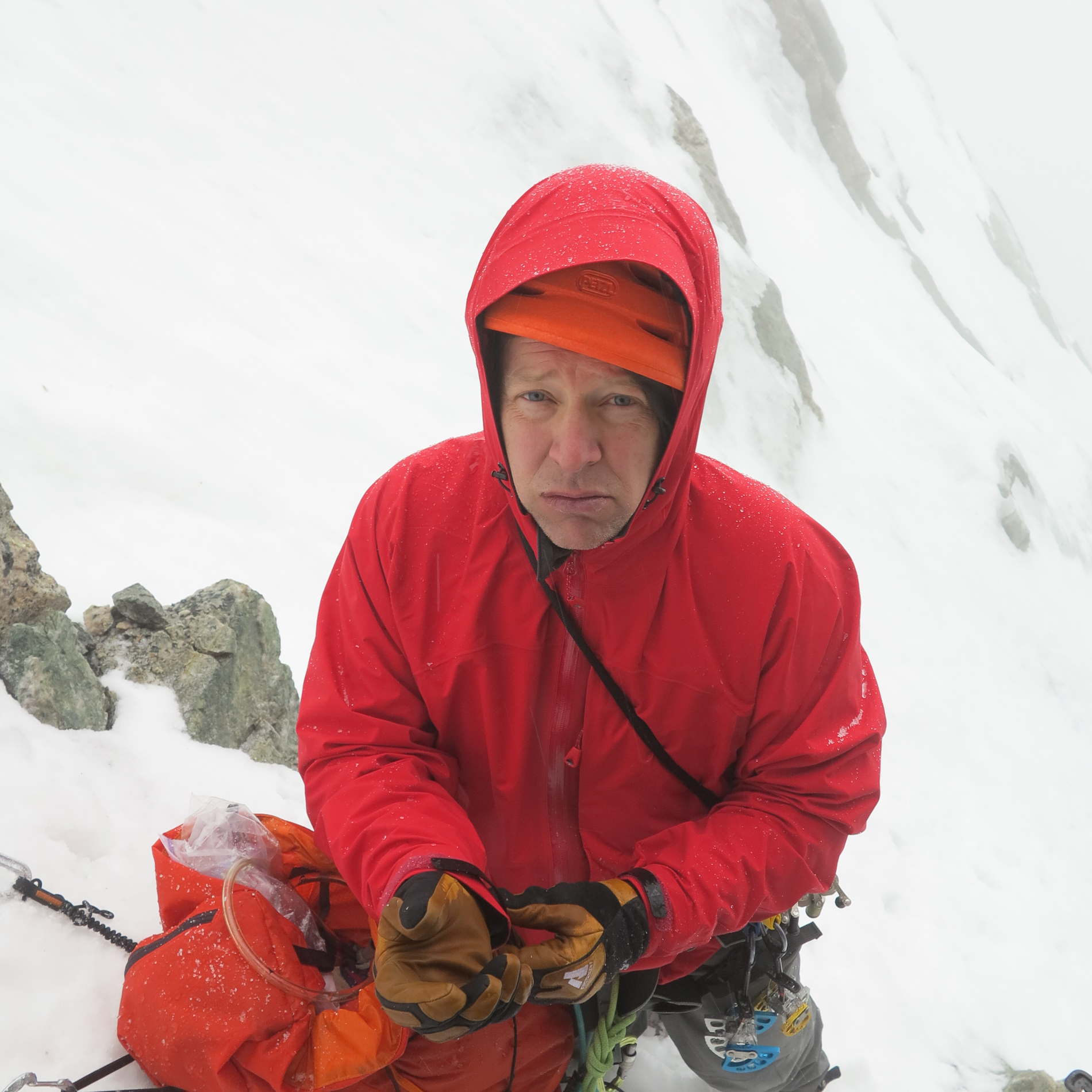
The next morning, we woke up at 5:00 ate some food, and hit the trail to the climb. The approach hike was steep and unpleasant, with lots of boulder hopping and shuffling up scree slopes. I was really happy when we reached the tongue of the big snow slope that leads to the Tower 1 Gully, and I could use my crampons. Moving up the steep neve snow was much better than groveling up the scree, and putting on my crampons made me feel like I was climbing at last.
We cruised up the snow slope unroped, and roped up when we reached the base of Tower 1 Gully. From the base of the route, we couldn’t really tell how long the climb was going to be. The guidebook says it’s ten pitches. From the bottom, with foreshortening, and no real way to judge scale, it didn’t look nearly that long. We wondered if it was really only going to be 2 or 3 pitches in length.
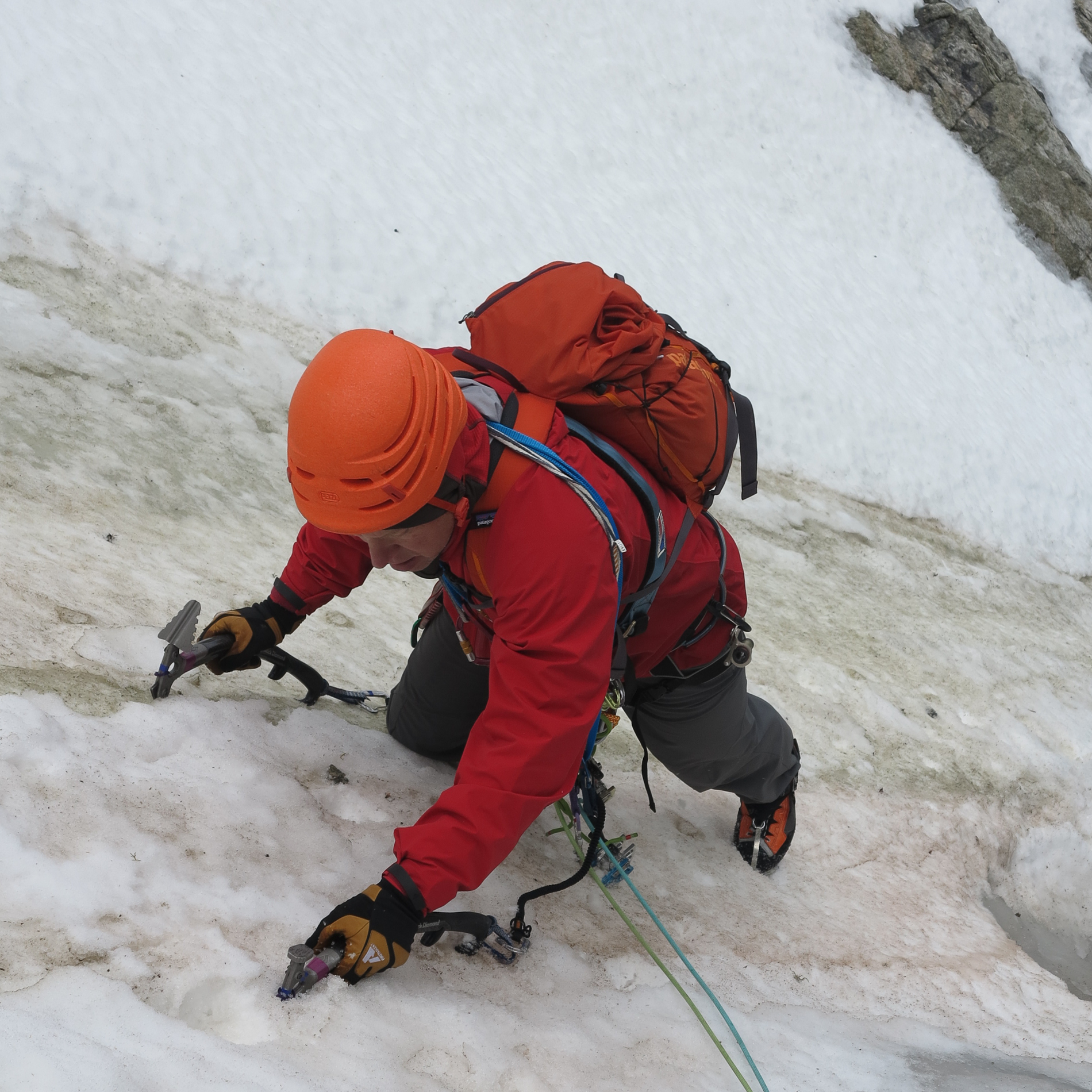
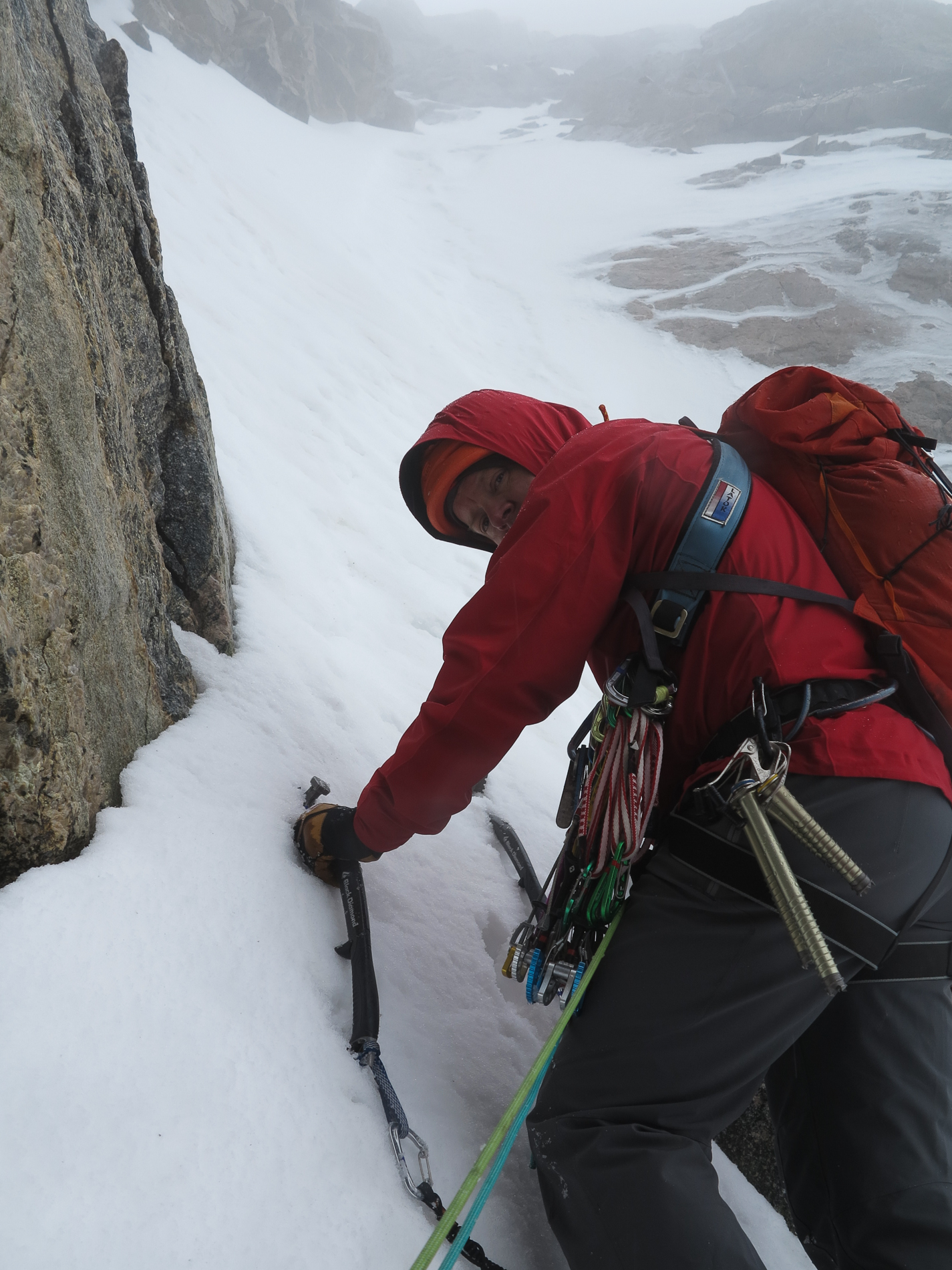
We began climbing, and it soon became apparent that the route was much longer than it appeared from below. That was a good thing, as the climbing was a lot of fun. The conditions were excellent. The route was mostly solid neve that took axe and crampon placements very securely. The neve alternated with consolidated snow and patches of water ice. The lower pitches were at a relatively low angle, and climbing went quickly. Although ice screw placements were not very common due to the fact that there wasn’t consistent sections of hard ice on the route, it was generally easy to get protection in the rock walls on the margins of the climb, where there were cracks for nuts, cams, and pitons.
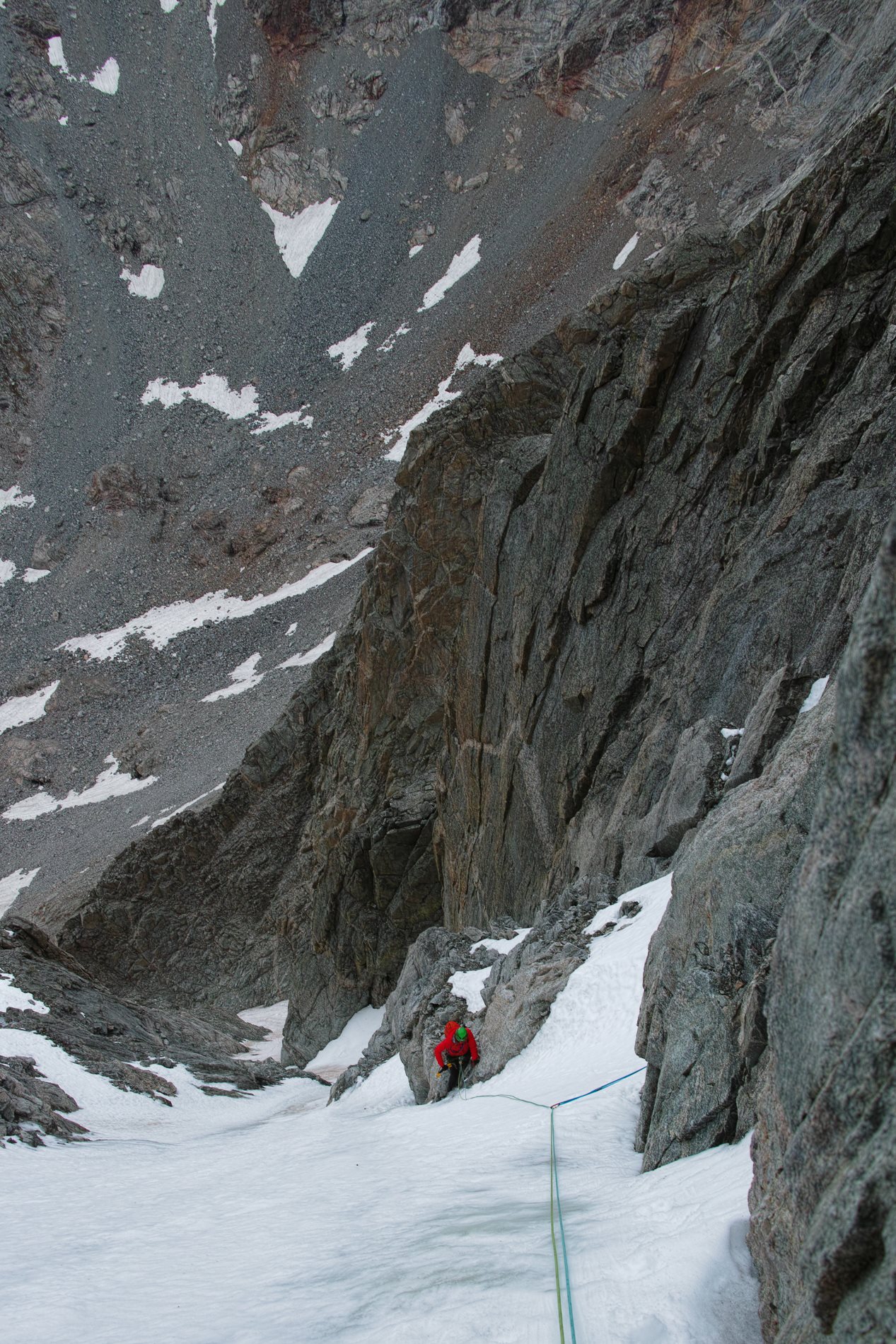
The climbing got steeper as the route progressed, and by the 4th pitch, it felt like real climbing, although it wasn’t particularly difficult due to the “thunker” ice conditions that provided for really secure tool and crampon placements. It was really enjoyable climbing, and we were both having a grand time of it.

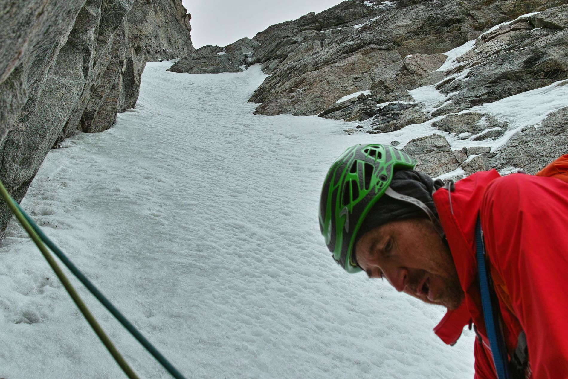
About the 3rd or 4th pitch, the weather began to change, and we started to get pelted with precipitation, first in the form of graupel, and then changing to snow. It wasn’t bad, however, and just gave the climb a bit more of an alpine flavor.
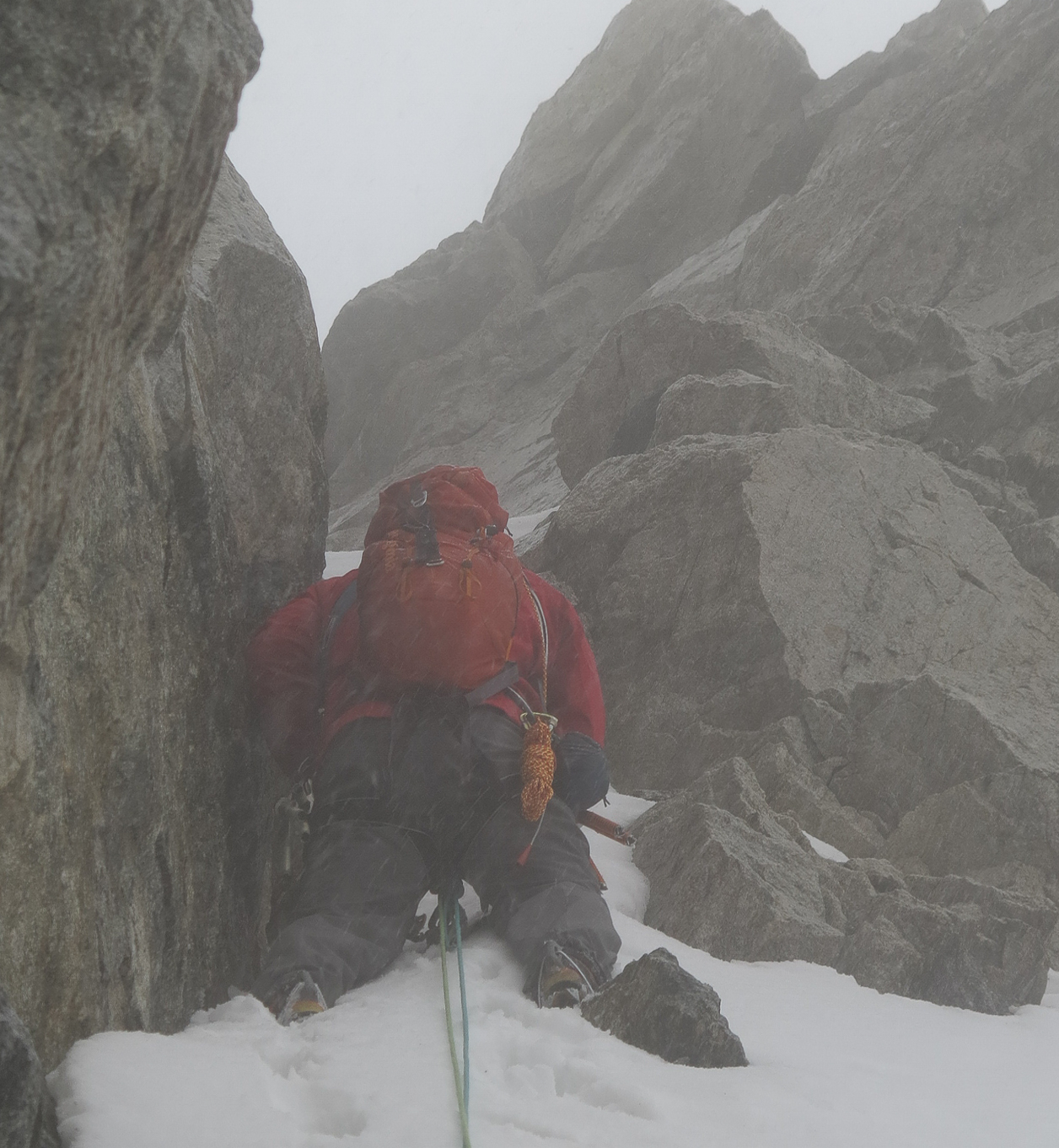
After 6 full pitches of neve, snow and ice, and one short pitch through the easy rock band at the top, we finished the route and topped out on the saddle between Tower 1 and Tower 2. By this time, the snow was falling hard, and the wind was blowing hard. When I pulled up over the top of the saddle, I got hit by icy wind driven snow. Our climb had been pretty sheltered, but this side of the mountain was getting pounded hard. Our plan for the descent had been to either continue to the top of Mount Helen and descend by the snow couloir, or rappel down the back side, or rappel down the climbing route on V-threads. The snow made continuing to the summit on rock much more challenging than we were interested in, and the thought of trying to rappel down the other side in the wind driven snow was also not appealing. We decided to descend back down the climbing route. We couldn’t use V-threads because there wasn’t sufficient water ice, so we used nuts hammered into cracks as our rappel anchors.

When we got the base of the route, we descended down the big snow couloir by a combination of down climbing, rappelling on a bollard, and a couple of rappels on some fixed gear we found in the (climber’s left hand) side of the couloir.
As we descended the route, the snow turned to sleet, then to hard driving rain. By the time we got back to our camp by the Titcomb lakes, we were both soaked. I was wearing a full waterproof hard shell jacket, but my pants were a water resistant soft shell (Patagonia Knifeblade.) These pants would have been fine for fending off a typical thunderstorm that only lasted an hour or so, but their water resistance was finally overwhelmed in the face of several hours of heavy wind-driven rain. As a result, my long johns were soaked, my socks were soaked, and my boots filled up with water.
The weather was unrelenting, with constant wind and heavy rain all night long. We spent a long, uncomfortable night in wet clothes, and damp down sleeping bags. I didn’t freeze, but I was just cold enough that whenever I started to fall asleep, the cold would make me shiver and wake me up again. I was just happy that it wasn’t 10 degrees colder. Had the temperature dropped a bit, I would have been really really cold, and we would have been facing a hike out in several feet of snow.
Next morning, we hurriedly crammed our soaking wet gear into our backpacks and began the 16 mile death march back to the car. It continued to rain all day, and the trails had turned into creeks, and the creeks into raging torrents. The only good news is that we started off with soaking socks and boots, so when we had to wade through calf-deep water, we weren’t getting any wetter.
After a really long, wet, exhausting day of hiking, carrying packs made even heavier by all the water weight, we finally reached the trailhead at a little before six in the evening. We changed into dry clothes, drove into Pinedale for a terrific dinner at a Mexican restaurant, and then headed back to Salt Lake.
Overall, the trip was very rewarding. The scenery was great, the climbing was fun, and the nasty weather gave us a generous dose of suffering that made us feel like we’d done some real alpine climbing.
Gear Notes:
2 ice screws are all that is really needed for this ice climb because of the plentiful opportunities for rock protection on the sides of the route. We didn’t place more than two screws on any pitch. We generally followed the left hand margin of the climb and found adequate cracks for running protection and belay anchors. A half set of Camalots (#.75 green to #3 blue) and 3 smaller Metolius cams, a set of stoppers, and 3 Tri-cams, along with a piton (#3 Moses Tomahawk) were more than enough for us to protect the climb and establish belays.
We left fixed rappel anchors along the route (varied between left and right hand sides) consisting mostly of stoppers “welded” into place by hammering them into the rock. If you use these anchors, make sure they are secure before you trust your life to them, as nuts can loosen over time.